White Sands National Monument comprises 41% of the 275 square miles of brilliantly white gypsum sand dunes which are just west of Alamagordo in the central Tularosa Basin of southern New Mexico. The Monument is next to Holloman Air Force Base and lies entirely within the White Sands Missle Range which contains the remaining 59% of the dune field.
The gypsum was originally dissolved in the vast inland sea which covered much of the area during the Permian Period some 250 million years ago near the end of the Paleozoic Era. The sea later dried up and the gypsum precipitated into thick layer. During the Larimide Orogeny that created the Rocky Mountains the gypsum layer was uplifted to form part of the San Andres Mountains. Still later, the Rio Grande Rift was formed, mostly along the Rio Grande River from southern Colorado to Chihuahua, Mexico, as the North American continent was stretched. The rifting formed the Tularosa Basin, among others. Then during the wetter climate of the last ice age the gypsum was washed down the mountainsides and again accumulated in ancient Lake Otero. That lake, too, devaporated in the increasingly dry climate of the most recent 12,000 years, leaving the much smaller Lake Lucero. Elsewhere the disappearance of Lake Otero caused the gypsum to precipitate out and become the Alkalia Flats, a playa along the base of the mountains. Prevailing westerly winds sweeping down from the mountains then picked up weathered gypsum sand and piled it into the large dune field that exists today.
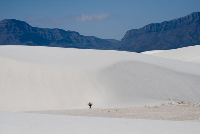
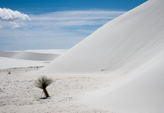
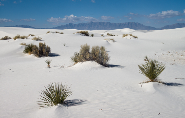
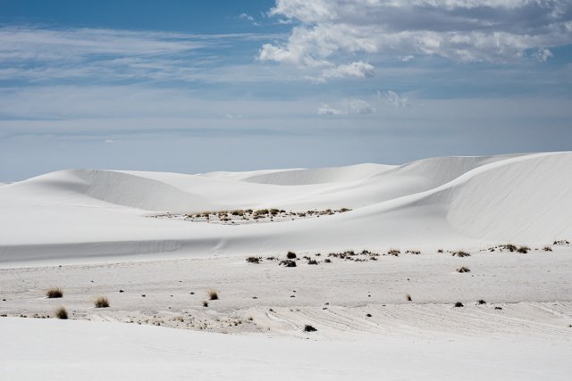
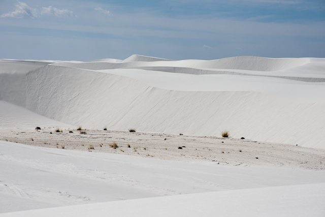
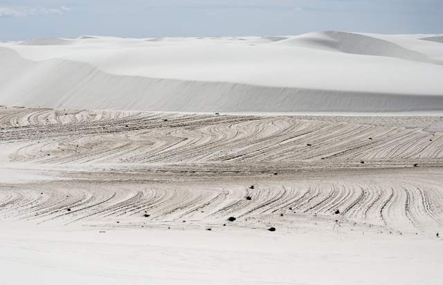
The dunes end abruptly along an irregular eastern edge where the dunes are small and low, and they are populated with yucca and grasses which are about as dense there as they are in the dry desert further east. Well within the dune field, as shown here, the dunes are up to about 60 feet high and often have flat areas separating them. These flat areas are the hard packed gypsum playa that underlies the dunes, and only very sparse yucca and clumps of grass grow there.
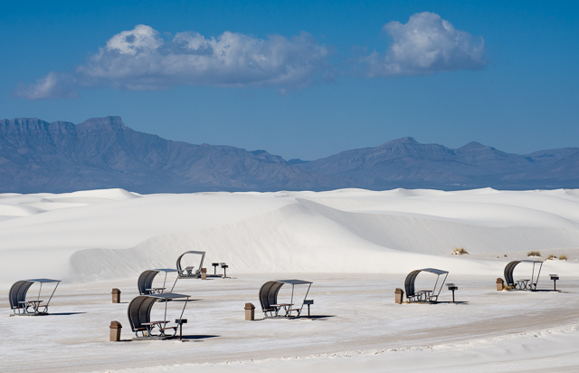
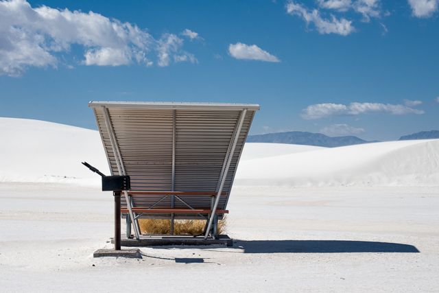
A two-lane paved road begins at the entrance station and skirts the dune for a few miles before entering the field where it becomes graded sand. Further along, side roads lead to three picnic area and to a few trailheads.
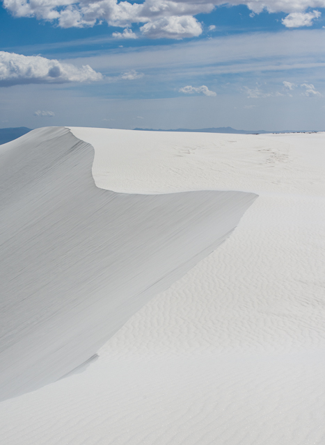
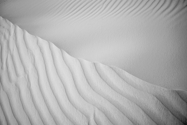
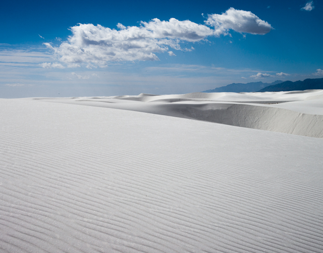
The overwhelming impression that the white sand dunes make is that of drifted snow. The sand is that white, and even though it does not have the interlocking crystals necessary to form overhanging cornices as snow does, the bare dunes beyond the plowed road, parking and picnic areas share their shapes with most other dunes and with snowdrifts: gently sloped and rounded windward hills that are covered with delicate, mostly linear ripples and which lead to much steeper and featureless slipfaces having the sand's angle of repose. The overall dune shapes are the familiar crescents that are also called barchans. Snow-like drifts, however, do not survive the temperatures at these dunes without producing copious amonts of water, so these white sand dunes in a hot desert but without any trace of water are a most incongruous sight to anyone familiar with drifted snow.
Although the seemingly ever-present wind does not often raise great clouds of blowing sand, it operates continuously to move sand up and over the dunes. Footprints barely a few minutes old are noticeably less distinct, because the transport of sand at the surface is very active if not obvious.
The Alkalai Trail winds about five miles over and around the dunes in the more remote west side of the dune field. The advice posted at the trailhead suggests that it will take about three hours to cover the distance. While that amount of time seems very long for no more than five miles, some experience following the trail quickly reveals that one cannot walk at one's usual pace when constantly climbing up and over dunes.
Although the sand coheres well enough to support one's weight in most places, many patches of loose sand conspire to substantially slow one down. But the effort to traverse the dunes is worthwhile as the best, and possibly only, way to expeience the more remote dunes which are the highest ones and are nearly pure sand with very few yucca and grasses growing on them.
The trail is well marked with tall thin posts strategically distributed about 100 meters apart with each successive post being visible from it's predecessor. Without these, the trail would be impossible to follow and getting lost would be very easy as the dunes have few distinguishing marks to provide natural signposts, while one's footprints quickly disappear to prevent one from retracing them.
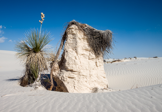
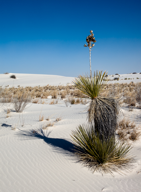
The dunes move very slowly, but they do move significant distances. This motion is confirmed when one understands the source of the tall mounds of consolidated gypsum that frequently exist on the windward side of a nearby dune. These mounds invariably occur under the remains of a dead plant whose roots, during its lifetime, bound the sand into the consolidated masses that then remained in place as the loose dune sand surrounding them blew away and the dune moved. Eventually, the mounds will degrade back into loose sand or they may be convered again by another advancing dune.